There is no going outside. There is no doing of things. There is only making sure that the air keeps moving, and finding the sweet spot to sit in for optimal ceiling fan coverage.
The truly great thing is that this heatwave hasn’t even concluded yet — that temperature was on Saturday — and meteorologists are already confidently forecasting the next one. That’ll be the third of the season.
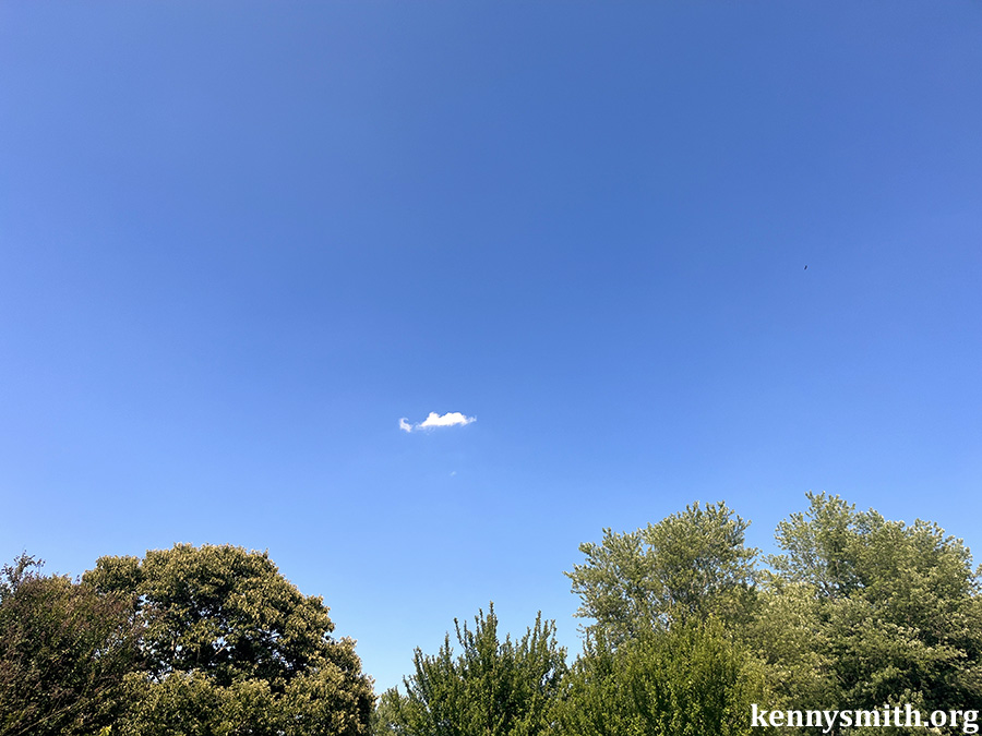
Also, this was the only cloud in the sky.
Poison ivy update: I have learned going outside is really uncomfortable now. All the places stressed by the blistery itchy irritated skin. It feels like the skin is being stretched apart and pulled together at the same time, somehow. Also, it just exacerbates the itching. This weekend I also graduated to oatmeal baths. They sounded silly, they still do, but also they seem helpful. Nice long soaks of the arms seem to give the Cortisone and Calamine a fighting chance at providing a little relief.
We are now approaching week two of poison ivy. Most people deal with this for two or three weeks. I bet I’ll be dealing with it for two weeks. Maybe three.
I have a complex relationship with giraffes. They are awesome. It is an unrequited appreciation. Few animals give off the same air of indifference, but that’s part of what makes them awesome. Here is a short clip of two we saw at Kruger National Park when we were on safari there last month.
The safari won me over on the first day. The views were lovely, the animals we encountered were outstanding and each one felt unique, and our guide was top notch. The entire experience was stress free, aside from early morning wake ups. If we ever find ourselves in South Africa again, and going on a safari again, it’ll be with Wild Wings. And if you’re considering doing such a thing, do it. And book it with Wild Wings. They were terrific.
We got VIP parking. We sat in lawn chairs in a public park, alongside the food trucks and across the way from the launch site and whoever put together the playlist. Just before it got fully dark the fireworks began, and they ran to their logical crescendo. There are fireworks across the country. I’m not sure how many of those will feel like 250, or how many will feature, for inexplicable reasons, Free Bird, but this show did.
The small towns have fireworks on the 3rd, I think so they will have an audience because of the much larger nearby show on the 4th.
The one we attended tonight had a musical pairing. The finale was Free Bird.
It was nice. It was easy. It was warm. The air quality was better, I guess, and then of course, we put a bunch of explosive propellants and smoke (during a drought) in the air for all of us to enjoy. Free Bird, indeed.
Thursday — Comments Off on This is absurd, weather edition02 Jul 26
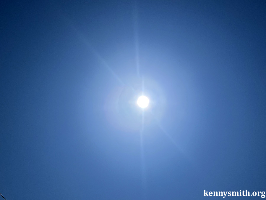
I went for a ride on the surface of the sun today and this will be the last time I do that for a few days. It’s a little silly. The heat index was 97 degrees at 11 a.m., when I took the defining photo of the day.
It did nothing less than make my skin hurt.
At the first of the month there is much computer work to be done. Templates must be updated. Additions must be made to spreadsheets. The desktop has to be cleaned, as does the downloads subdirectory. The trash must be emptied. New subdirectories must be made on the website.
Also, I laid out a bunch of stuff that’ll appear on the site starting next month. And I added new banners to the header and the footer here. One got eight additions and the other got seven. Those images randomly load each time you come to the page, or refresh. And you should refresh a lot. There are 133 headers and 134 footers see now. How many is enough? No one knows. There’s also a back end page I keep for all of those images and … well, this all takes a few minutes.
Plus I’m itching. Plus I’m reading.
Hey, I put 223 photos and six videos on the site last month. I told you we were going to have some slow days in the near future. That future is now.
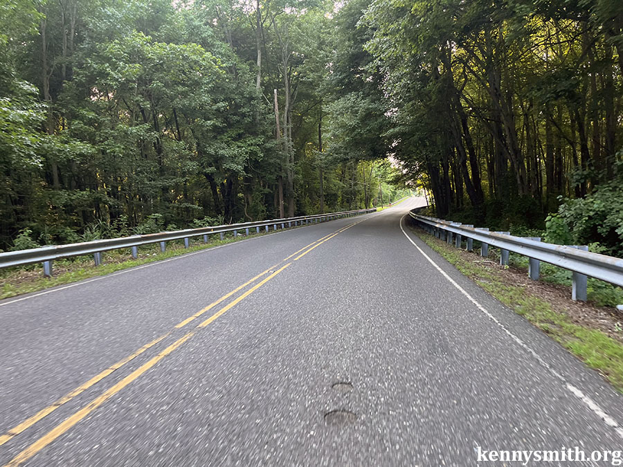
I rode my 25-mile time trial route today. This is the 13th time I’ve done this route, and that doesn’t matter. My time today was right in the middle of the 13 times, and that doesn’t matter. Top half by 16 seconds, and that doesn’t mean anything. It could have been the wind or a little better fueling or I just sat up a few seconds earlier on one day than the other. It doesn’t matter.
Maybe I took one less photograph this day than that slightly slower day that separates the two halves of the sample.
That’s about halfway through the route. I just like the way the road dips into those trees, how they carve a bit of darkness out of the brightness of day. Each time I’m on that road I imagine the next little bit to be something like spelunking on wheels, but it’s just a patch of trees, a good canopy that will soon open back up to the sky. Too soon, on some days, like today.
It is official, heat is hot, and right now heat is bad. Also, it’s going to get hotter.
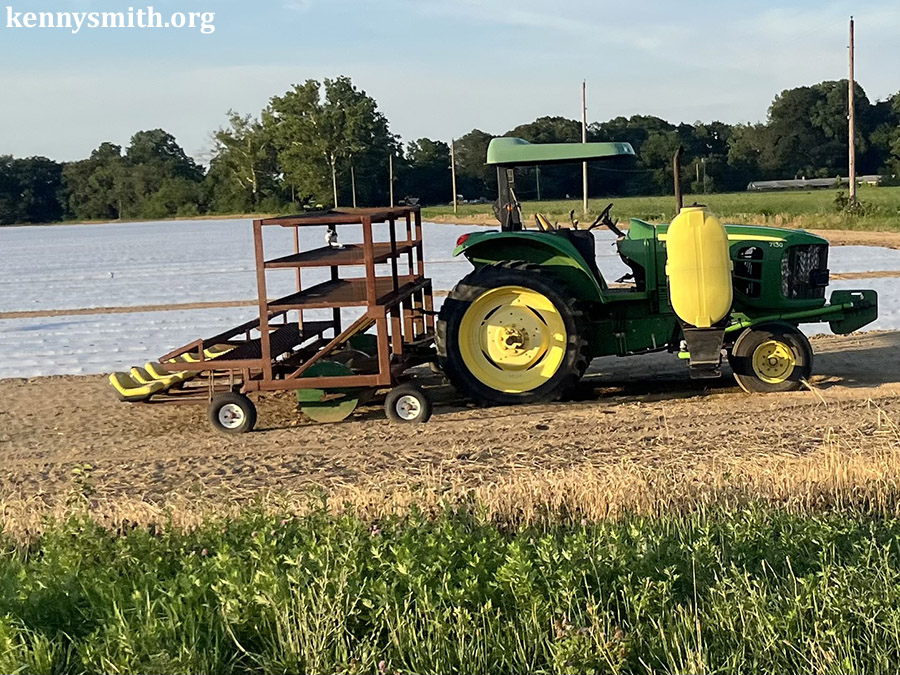
When your skin is under siege — and urushiol is a siege — heat isn’t especially pleasant. The cab of this tractor is air conditioned.
My bicycle is not. But maybe if I’d gone faster? Maybe if today’s ride had found its way to the top of the spreadsheet.
May as well start digging out from this stack of CDs I’m under. I was doing something here I called the Re-Listening Project, where I was playing all of my old CDs in the order of their acquisition. More or less. When last we did this I was in a batch of CDs that replaced some that had been stolen. It’s a weird bit of decades old nonsense that serves only to confuse me for something that only interests me, but, hey, my name is at the top of the site. Also, I’m probably way behind in this little effort which, again, is a singular indulgence. The point was to put a few songs from each disc here, maybe think up something interesting about them. This never was a review, because no one needs more of those.
At this point, I’m just trying to take some discs out of the Re-Listen To Do pile and put them back in the old books. It’s a big stack.
Daylight was Duncan Sheik’s third studio album. (He’s up to nine, now.) It was released in 2002, and I probably bought this soon after. (Shame on me for not clearly remembering that detail.)
This was a single, and found its way into a movie, a teen comedy few remember.
This one sounds romantic. Has great imagery. And even the narrator knows that it is in no way true. It was, and remains, my favorite song on the album.
For a long time I played this CD on my way into the studio, because singing along, I thought, might just lower my speaking tone a bit for the day. And during that time part of this song fit the vibe. A sarcastic sing-along was, I thought, just one of the most clever things you could do in a deep cut.
There might have been a breakup right around that time.
The next one is Deuces Wild, B.B. King’s thirty-fifth studio album, which was released in 1997. Each song features a second musician, and so this was one those homage-slash-gimmick records. Also, it is quite good. With appearances by Van Morrison, Eric Clapton, Mick Hucknall, Bonnie Raitt, D’Angelo, Jools Holland, Dr. John, Marty Stuart, Dionne Warwick, Paul Carrack, The Rolling Stones, Zucchero, and David Gilmour how could it not be great?
Also, it had these three tracks, which are automatic favorites for a variety of reasons. The first being Tracy Chapman, because Tracy Chapman is absolute dynamite in everything she does.
And this one, because the idea of Heavy D seducing Lucille is too hilarious to overlook. Plus, the entire concept is fun. There’s just enough mirth in King’s voice to allow this to be nearly timeless.
Speaking of. This song was released in 1960. King played it as far back as 1967, at least. King and Willie Nelson did it way back in 1984, at least. As a duet, the two of them have had it in their repertoire since 1984 at the very least.
I remember hearing this track for the first time and thinking it felt like something as a sad dirge. This could be the last time and all of that. But King played for another 17 glorious years after this was released. I’d been in crowds at concerts where the audience had serenaded Willie Nelson on his birthday. More than once, as I recall. And he marked his 90th birthday, in 2023, with two concerts at the Hollywood Bowl. He’s timeless, so is King. So is this. Enjoy the man hailed as the single most important electric guitarist of the last half of the 20th century and one of the greatest troubadours and musician of his, this, or any generation.
That song is 66 years old, and a timeless treasure. Willie Nelson was just 26 or 27 when he wrote it on the road. Looking back, I don’t even think I could understand, truly understand, the song at that age. While it is amazing that he could right something that would persist as this has, we’re all just fortunate that it has stuck around for each of us, when we’re ready.
And, with that, I am something like 35 discs behind.